- Diese event hat bereits stattgefunden.
Fortbildung: Vermessung im Vorbeifahren?
15. September 2022

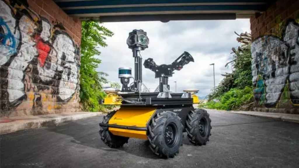
Mobile Erfassungssysteme zu Land zu Wasser und per pedes
Das Weiterbildungsseminar zum Thema Vermessung im Vorbeifahren? – Mobile Erfassungssysteme zu Land zu Wasser und per pedes richtet sich an alle Interessierten, die an mobiler Echtzeitvermessung Interesse haben. Einer theoretischen Einführung zu den möglichen Systemen und der Kalibrierung der Sensoren folgen Berichte aus der Vermessungspraxis und Kurzvorträge der ausstellenden Firmen. Begleitet wird die Veranstaltung durch eine Firmenausstellung.
Lernziele
[fusion_fontawesome icon=“fa-angle-right fas“ size=““ flip=““ rotate=““ spin=“no“ link=““ linktarget=“_self“ alignment_medium=““ alignment_small=““ alignment=““ hide_on_mobile=“small-visibility,medium-visibility,large-visibility“ sticky_display=“normal,sticky“ class=““ id=““ margin_top=““ margin_right=““ margin_bottom=““ margin_left=““ iconcolor=““ hue=““ saturation=““ lightness=““ alpha=““ iconcolor_hover=“var(–awb-custom11)“ circle=““ bg_size=“-1″ circlecolor=““ circlecolor_hover=““ circlebordersize=““ circlebordercolor=““ circlebordercolor_hover=““ border_radius_top_left=““ border_radius_top_right=““ border_radius_bottom_right=““ border_radius_bottom_left=““ icon_hover_type=““ animation_type=““ animation_direction=“left“ animation_speed=“0.3″ animation_offset=““][/fusion_fontawesome] Verknüpfung von Komponenten
[fusion_fontawesome icon=“fa-angle-right fas“ size=““ flip=““ rotate=““ spin=“no“ link=““ linktarget=“_self“ alignment_medium=““ alignment_small=““ alignment=““ hide_on_mobile=“small-visibility,medium-visibility,large-visibility“ sticky_display=“normal,sticky“ class=““ id=““ margin_top=““ margin_right=““ margin_bottom=““ margin_left=““ iconcolor=““ hue=““ saturation=““ lightness=““ alpha=““ iconcolor_hover=“var(–awb-custom11)“ circle=““ bg_size=“-1″ circlecolor=““ circlecolor_hover=““ circlebordersize=““ circlebordercolor=““ circlebordercolor_hover=““ border_radius_top_left=““ border_radius_top_right=““ border_radius_bottom_right=““ border_radius_bottom_left=““ icon_hover_type=““ animation_type=““ animation_direction=“left“ animation_speed=“0.3″ animation_offset=““][/fusion_fontawesome] Kalibrierung und sonstige Systemparameter
[fusion_fontawesome icon=“fa-angle-right fas“ size=““ flip=““ rotate=““ spin=“no“ link=““ linktarget=“_self“ alignment_medium=““ alignment_small=““ alignment=““ hide_on_mobile=“small-visibility,medium-visibility,large-visibility“ sticky_display=“normal,sticky“ class=““ id=““ margin_top=““ margin_right=““ margin_bottom=““ margin_left=““ iconcolor=““ hue=““ saturation=““ lightness=““ alpha=““ iconcolor_hover=“var(–awb-custom11)“ circle=““ bg_size=“-1″ circlecolor=““ circlecolor_hover=““ circlebordersize=““ circlebordercolor=““ circlebordercolor_hover=““ border_radius_top_left=““ border_radius_top_right=““ border_radius_bottom_right=““ border_radius_bottom_left=““ icon_hover_type=““ animation_type=““ animation_direction=“left“ animation_speed=“0.3″ animation_offset=““][/fusion_fontawesome] teil- und vollautomatische Auswertung in Verbindung mit KI
[fusion_fontawesome icon=“fa-angle-right fas“ size=““ flip=““ rotate=““ spin=“no“ link=““ linktarget=“_self“ alignment_medium=““ alignment_small=““ alignment=““ hide_on_mobile=“small-visibility,medium-visibility,large-visibility“ sticky_display=“normal,sticky“ class=““ id=““ margin_top=““ margin_right=““ margin_bottom=““ margin_left=““ iconcolor=““ hue=““ saturation=““ lightness=““ alpha=““ iconcolor_hover=“var(–awb-custom11)“ circle=““ bg_size=“-1″ circlecolor=““ circlecolor_hover=““ circlebordersize=““ circlebordercolor=““ circlebordercolor_hover=““ border_radius_top_left=““ border_radius_top_right=““ border_radius_bottom_right=““ border_radius_bottom_left=““ icon_hover_type=““ animation_type=““ animation_direction=“left“ animation_speed=“0.3″ animation_offset=““][/fusion_fontawesome] Mobile Systeme im Praxiseinsatz
Zielgruppe
Vermesser*innen, Geodät*innen, Planer*innen, Bauingenieur*innen, Umweltingenieur*innen, Geograph*innen, Archäolog*innen, Geolog*innen, Straßen- und sonstige Infrastrukturerhalter, BIM-Verantwortliche, …
[fusion_button link=“https://www.uibk.ac.at/geometrie-vermessung/veranstaltungen/geodaesie/vermessung_aktuell/einladungsfalter-mobile-systeme.pdf“ title=““ target=“_self“ link_attributes=““ alignment_medium=““ alignment_small=““ alignment=““ modal=““ hide_on_mobile=“small-visibility,medium-visibility,large-visibility“ sticky_display=“normal,sticky“ class=““ id=““ color=“custom“ button_gradient_top_color=“var(–awb-color6)“ hue=““ saturation=““ lightness=““ alpha=““ button_gradient_bottom_color=““ button_gradient_top_color_hover=““ button_gradient_bottom_color_hover=““ gradient_start_position=““ gradient_end_position=““ gradient_type=““ radial_direction=““ linear_angle=“180″ accent_color=“var(–awb-color1)“ accent_hover_color=““ type=““ bevel_color=““ bevel_color_hover=““ border_top=““ border_right=““ border_bottom=““ border_left=““ border_radius_top_left=““ border_radius_top_right=““ border_radius_bottom_right=““ border_radius_bottom_left=““ border_color=““ border_hover_color=““ size=““ padding_top=““ padding_right=““ padding_bottom=““ padding_left=““ fusion_font_family_button_font=““ fusion_font_variant_button_font=““ font_size=““ line_height=““ letter_spacing=““ text_transform=““ stretch=“default“ margin_top=““ margin_right=““ margin_bottom=““ margin_left=““ icon=““ icon_position=“left“ icon_divider=“no“ animation_type=““ animation_direction=“left“ animation_speed=“0.3″ animation_offset=““]Anmeldung[/fusion_button]
Info:
Abschluss
Teilnahmebestätigung der Universität Innsbruck
Dauer/ECTS-AP
1 Tag
Start
15.09.2022
Kosten
290 EUR
Unterrichtssprache
Deutsch
Bild: (c) Universität Innsbruck